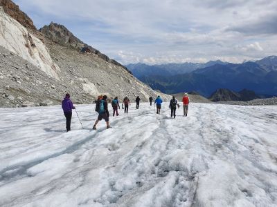
Every year the Drones For Earth team heads out to complete a project altogether. Besides reviewing all aspects of a drone mapping mission, from planning and preparing to capturing the data and processing, it’s also about having a great time together!
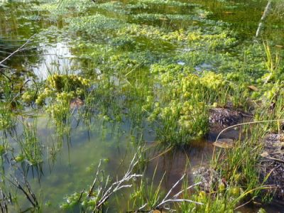
This mission is a follow-up of the Eigenthal and Rothenthurm bogs mapping, previously conducted with Pro Natura. The goal is to collect data to perform hydrologic simulations, and plan better the future work to preserve the bogs.
What happens when you mix ancient Bushmen knowledge with the latest in drone technology? Our experiment of joining these two very opposite worlds presents a completely new way of counting wildlife.
Exactly one year after our first mission to Namibia for the SAVMAP project, a team made up of Drones For Earth, EPFL’s LASIG lab and Kuzikus Wildlife Reserve came together again in the Southern African savanna from May 16 to 23, 2015 to apply last year’s findings and push the limits of civilian drone use for nature conservation applications one step further.
Protecting endangered animals like the Black Rhino and plants like the endemic and fascinating Welwitschia mirabilis, proposing new ways of managing land sustainably in semi-arid savannas and finding new approaches to counting wildlife were all important topics on our agenda this year.
Timothée Produit of EPFL’s LASIG lab was part of our Namibian mission in May 2014. During the mission, Tim gave lectures both at the Polytechnic of Namibia as well as at the Gobabeb Research & Training Center on how to use the acquired drone imagery to classify terrain. Once all the imagery of the mission had been processed back home in Switzerland, Tim went on to use our data for classification purposes.
In this blog, we explore how to use multi-spectral imagery acquired by the eBee, processed into orthomosaics using Pix4Dmapper, to create vegetation base maps.
Most Drones For Earth missions to date have involved using eBee mapping drones to assist humanitarian projects. However in recent months we have taken part in an increasing number of environmental conservation projects too, such as our recent Namibia mission.
Here in Switzerland we were contacted by Pro Natura, a non-profit conservation organization with over 100,000 members, to help with a unique biodiversity project – using drones to create orthomosaics and terrain models of an ancient peat bog in need of regeneration.
Following the redevelopment work of site one, the presence of so much surface water and tufts of new dark green vegetation now indicate a healthy site.
The mission in numbers:
Project performed in: 2014
Sites mapped: 2 (1 for immediate redevelopment, 1 for future redevelopment)
Days: 0.5
Drones For Earth staff: 3
Pro Natura staff: 1
Total flights: 4 (2 covering site 1, with 2 further flights over site 2)
Flight coverage:
Flights 1 & 2 (site 1): 0.23km2
Flights 3 & 4 (site 2): 0.35 km2
Camera payload: RGB
Total images acquired: 1,061
Orthomosaic accuracy: 3.4 cm (1.3 in) per pixel
Digital surface model accuracy: 4.4 cm (1.7 in) per pixel
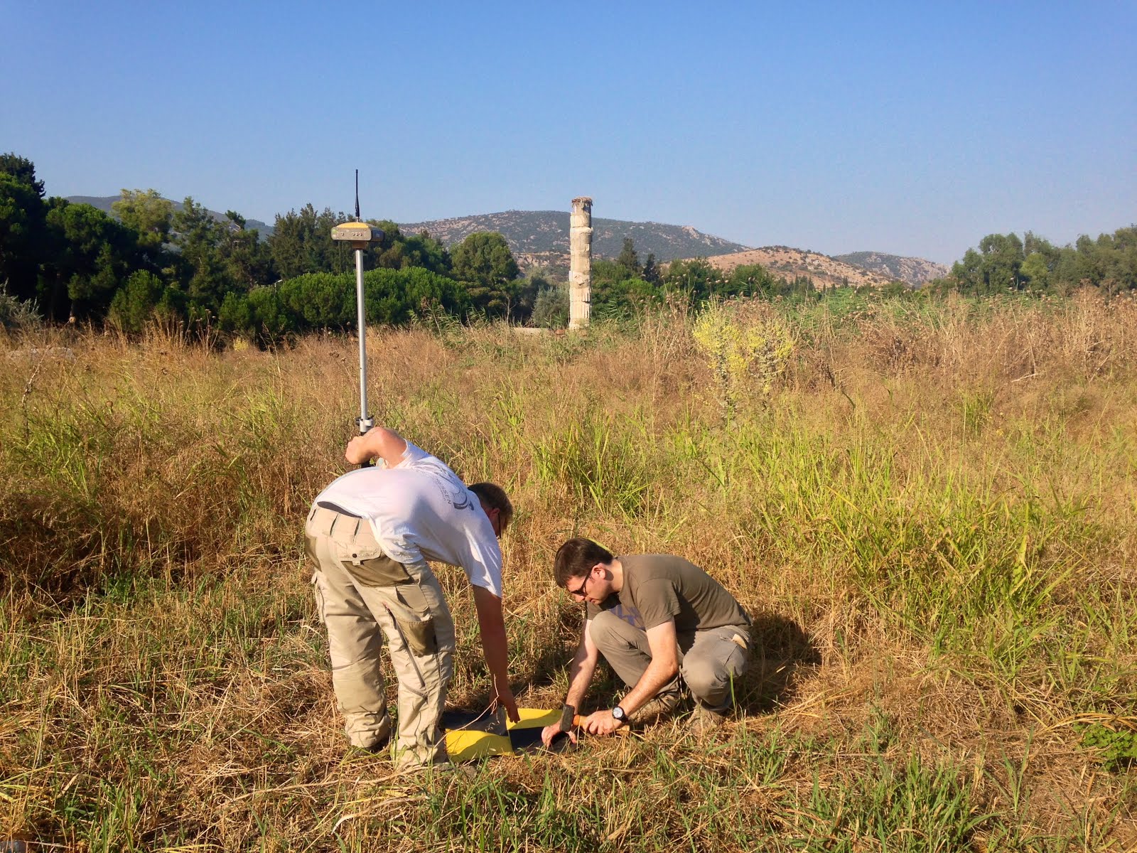
It isn’t every day that we get to fly drones over one of the Seven Wonders of the Ancient World. Thanks to our intrepid partners and hosts, the Institute of Fine Arts at New York University (NYU) and the Austrian Archaeological Institute, we’ve just returned from an amazing week in Southern Turkey where we flew over ancient theatres and temples dating as far back as the 10th Century BC.
Setting up Ground Control Points (GCPs) to improve the precision of the imagery. In the background, one of the Seven Wonders of the Ancient World: The Temple of Artemis in Ephesus, Turkey.
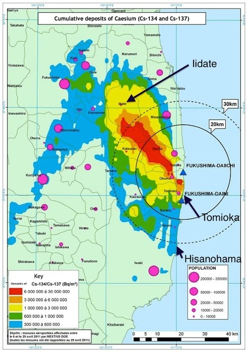
It’s been three years since a massive magnitude 9.0 earthquake and subsequent tsunami destroyed large parts of the eastern coast of Japan and incapacitated the Fukushima Daiichi nuclear power plant. Life for many of the displaced families, however, has far from returned to normal; around 150,000 residents of the prefecture are still living as evacuees in temporary accommodations, and many villages are still too contaminated for people to return.
What is the current state of the cleanup and reconstruction effort? Drones For Earth teamed up with Taichi Furuhashi, researcher at the Center for Spatial Information Science at the University of Tokyo, to try to answer this question. Over the course of several days, we mapped three unique towns in Fukushima district: Iidate village, Hisanohama, and Tomioka.
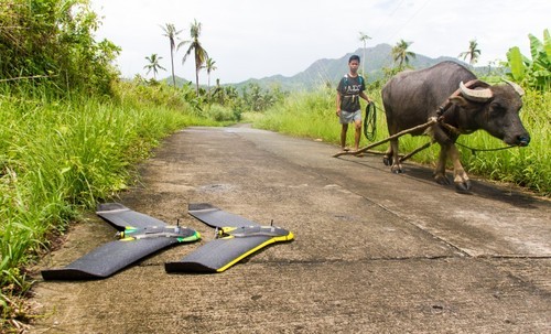
When Typhoon Haiyan, known as Yolanda in the Philippines, struck the South East coast of the country six months ago, on November 8, 2013, it devastated entire communities – tearing apart thousands of homes and destroying livelihoods. Many of those worst hit were ‘informal’ unplanned homes, situated at or near the water’s edge.
One of the humanitarian organisations that stepped up to help was Swiss-based Medair, which is dedicated to relieving human suffering in some of the world’s most remote and badly affected places. However after arriving in the country just 48 hours after Yolanda struck and conducting their initial assessments, the Medair team soon discovered that accurate, up-to-date maps of the region didn’t exist, with communities often having to rely on either hand-drawn maps or outdated Google versions.
This data gap is why Medair asked Drones For Earth to get involved.
Create detailed 2D base maps and 3D terrain models of Tacloban, Dulag and Julita municipalities
Assess typhoon damage and plan shelter reconstruction